Add to favorites
- Difficulty: Easy-medium

- Warnings: Criss-crossing mountain bike trails can make it difficult to route find at times.
- Wheelchair accessible: No
- High-clearance 4×4 advised to access trailhead? No
- Best seasons: Spring, summer, fall
- Distance (including access trail): 4km/2.5mi
- Approx. time (return): 1.5-2.5 hrs return (including the access trail)
- Elevation gain: 394 ft/120 m
- Steepest grade: A few steeper sections, but mostly flat
- Viewpoints: from the boardwalk views of lush forest, babbling brooks.
- Geocache points: Unknown
- Closest bathroom/outhouse: 5-Mile Parking lot outhouse
- Cell service? Spotty.
- Gear to bring: Bring water, bug spray and footwear with good tread (hiking boots recommended) as some parts of the trail can be slippery when wet.
Trail Description:
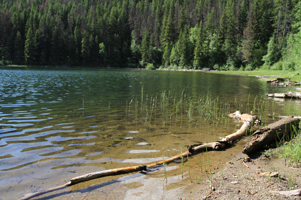
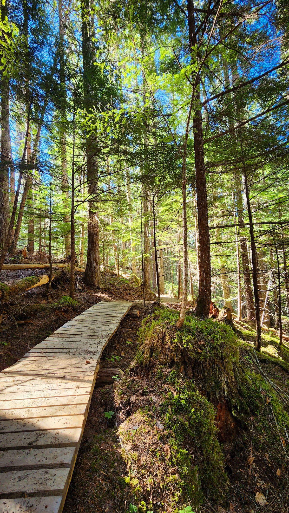
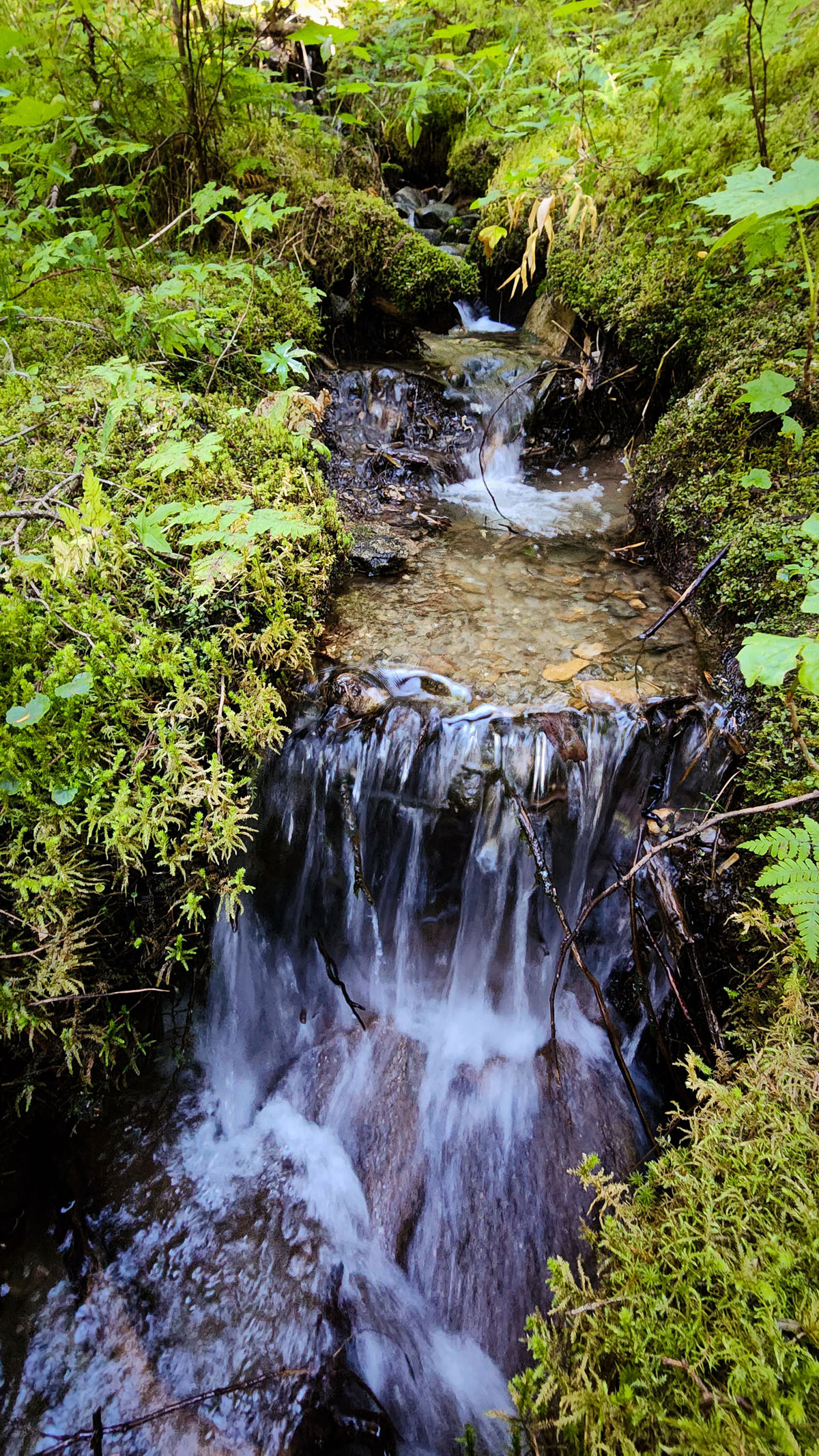
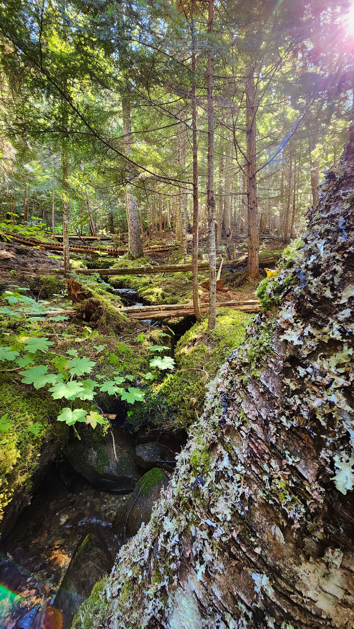
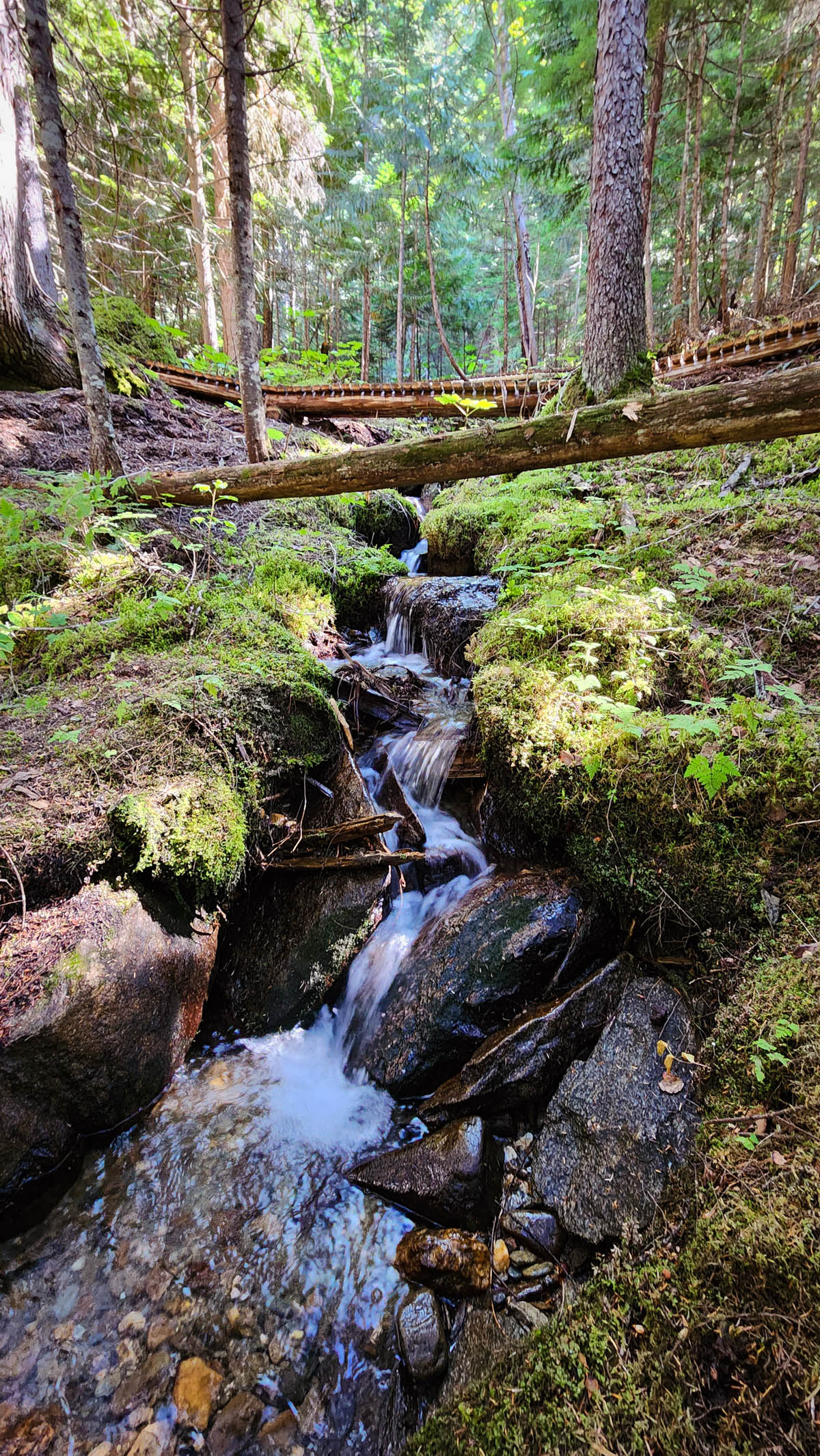
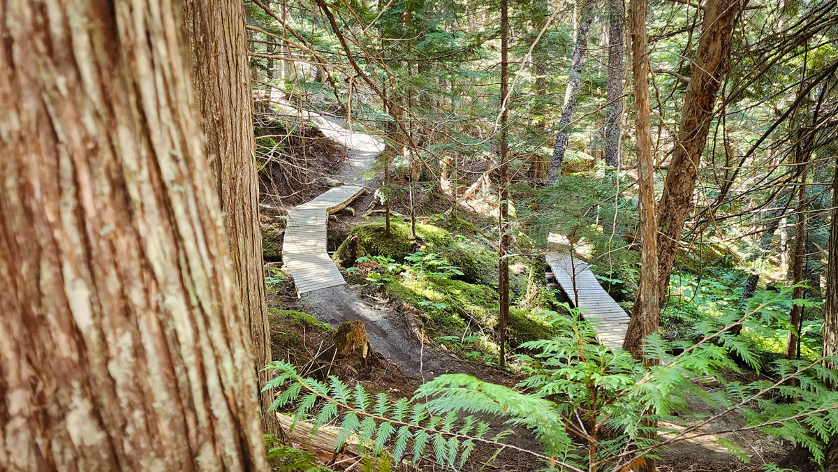
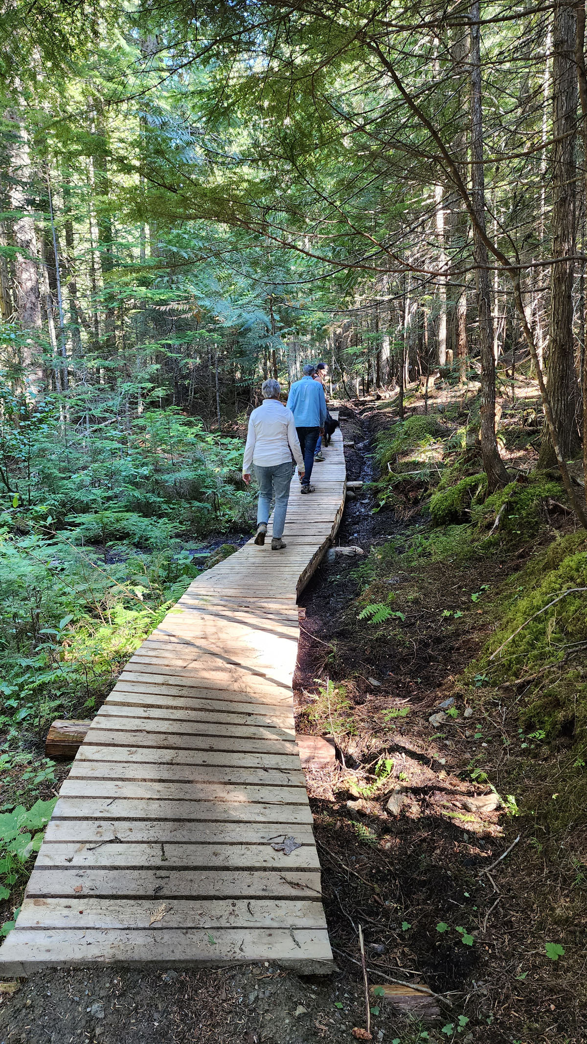
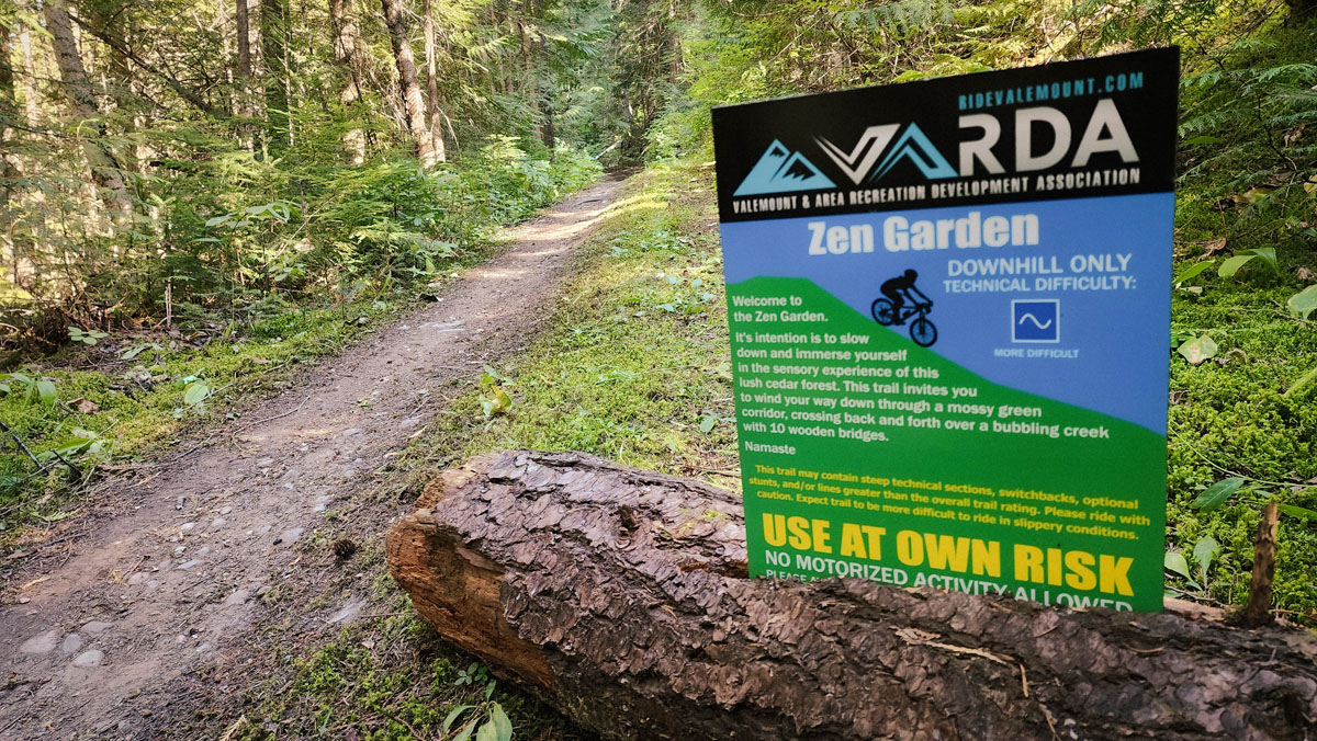
One of Valemount’s newest mountain bike trails is being hailed by hikers as a fantastic walk in the woods. Zen Garden is a 0.3km trail that zig-zags between two other access trails on the northside of 5-Mile. Access to the trail from 5-Mile is possible via Truck Yeah and an old road that’s now used as a connector for many downhill bike trails. As signage is limited, it’s best to go with someone who is somewhat familiar with the route. The zen garden trail is comprised of a series of boardwalks that criss-cross a lovely mountain stream that descends the slope in a series of small crystal-clear pools. The sound of babbling water alone is enough to lower your heart rate. Much of what makes Zen Garden so peaceful are the small details – horizontal devil’s club leaves fanning out over a picture-perfect waterfall between two rocky pools of ultra-clear water; a seedling growing out of a moss-covered stump; the dappling of sunlight coming in sideways through the trees.
The trail can be done as a partial loop, returning up via a lower portion of Truck Yeah or the old Swift Creek trail via the skid road. The entire hike there-and-back from 5-Mile is roughly 4km long. For those on foot, it’s a very reasonable hike, though the base of the trail plus the access trail does involve about 120m of elevation change and some short muddy sections.
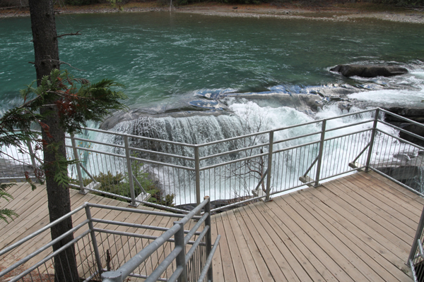
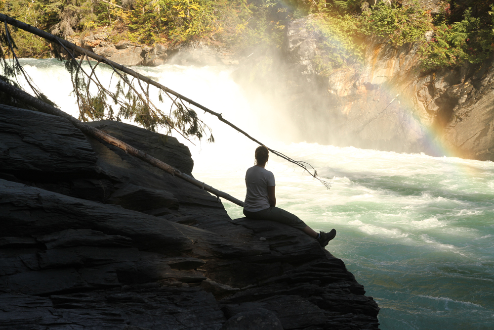
Best Parts: World-class waterfalls, lush forest, views of glaciers, waterfall mist, and great photo opps.
Worst Parts: The trail gets slippery when wet and it’s hard to grip unless you’re wearing good hiking shoes. The bottom trail becomes very soggy during wet weather. Hiking poles, good shoes and caution are recommended for these sections. Be sure to make lots of noise so you don’t surprise any bears and they have time to leave to avoid an encounter.
GPS Zone
Trailhead coordinates: 52.8493663,-119.2520857
GPS Tracks (Right click, Save link as)
Download Trail GPX file
Download Access GPX file (PENDING)
How to access/where to park: Park near the entrance to Truck Yeah OR the Swift Creek #6 Mainline entrance on 5-Mile Road, depending on which route you are taking. Park as far off the road as possible. Click here for Google Maps directions.