
 Add to favorites
- Difficulty: Easy

- Warnings: No official warnings, check social media feeds below for current trail status updates.
- Wheelchair accessible: No
- High-clearance 4×4 advised to access trailhead? No
- Best seasons: Spring, summer, fall
- Distance: Trail portion is 0.27 km/0.17 miles one-way
- Approx. Time: 15 minutes
- Elevation change (min to max): Minimal
- Steepest grade: One steeper section at the southern trailhead (approx 20%)
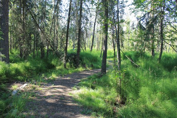
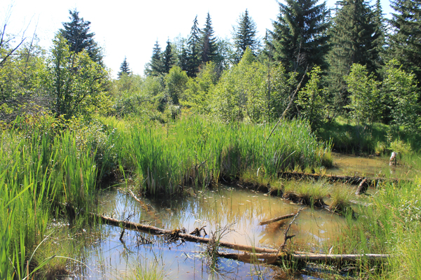
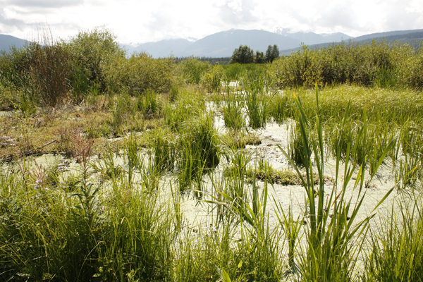
- Viewpoints: No mountain viewpoints from the trail, but many varieties of marshland vegetation and fauna can be enjoyed throughout the trail.
- Geocache points: Unknown
- Closest bathroom/outhouse: Outhouse at the parking lot and washrooms at the Visitor Centre (adjacent to southern trailhead)
- Cell service? Yes
- Gear to bring: During wet weather waterproof footwear is recommended as is mosquito spray
Trail Description:
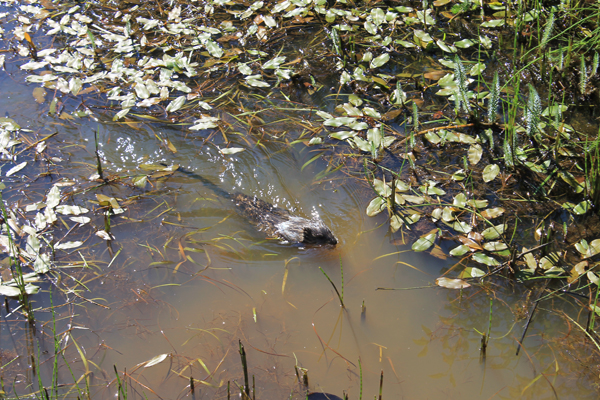
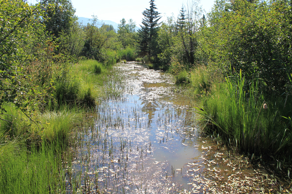
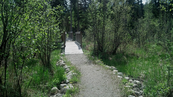
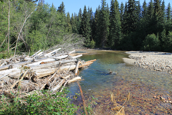
A very accessible and short trail, George Hicks Park trail weaves its way through a marsh adjacent to the salmon viewing area on Swift Creek. If you want to get off the highway and experience nature, this is easily accessible to stretch your legs. View tadpoles, dragonflies, muskrats, frogs, and an assortment of marsh creatures. Right next to this trail is the salmon spawning viewing area at Swift Creek. View Chinook salmon during the last leg of their spawning journey from mid-August to mid-September.
Best Parts: The wildlife viewing can be great, especially for small animals and insects in springtime – birds, ducks, tadpoles, frogs, muskrats, dragonflies to name just a few.
Worst Parts: If the weather has been wet recently, some parts of the trail may be mucky. Due to the proximity to the highway, you can hear traffic. Sometimes garbage collects in the area due to highway traffic. The mosquitoes can also be bad during the early summer.
GPS Zone
Trailhead coordinates: Plug these into a GPS or Google Maps search bar
52.833585°, -119.281875° (Near creek)
52.831917°, -119.281149° (Near visitor centre)
GPS Tracks (Right click, Save link as)
Download Trail GPX file
How to access/where to park: 1) From the Valemount Visitor Centre, head downhill towards the creek (towards the salmon viewing signs) about 250 m. Park at the parking lot next to the creek and the highway overpass. Northern trailhead starts at the parking lot. Southern trailhead starts just downhill from the Visitor Centre (look for trailhead sign). Click here for Google Map Directions
Elevation profile map:

