
 Add to favorites

- Difficulty: Hard

- Warnings: This trail is inaccessible during winter.
- Wheelchair accessible: No
- High-clearance 4×4 advised to access trailhead? no
- Best seasons: summer, on a clear day
- Distance (return mine): 9 km / 5.7 mi
Distance (return ridge): 9.65 km / 6 mi - Approx. time to mine (return): 6-7 hrs return (accessing the trailhead will take approx. 45mins from Valemount)
- Elevation gain to mine: 3025 ft / 922 m
Elevation gain to ridge: 3343 ft / 1018 m - Steepest grade: Steep to mine; very steep to ridge (30-40%)
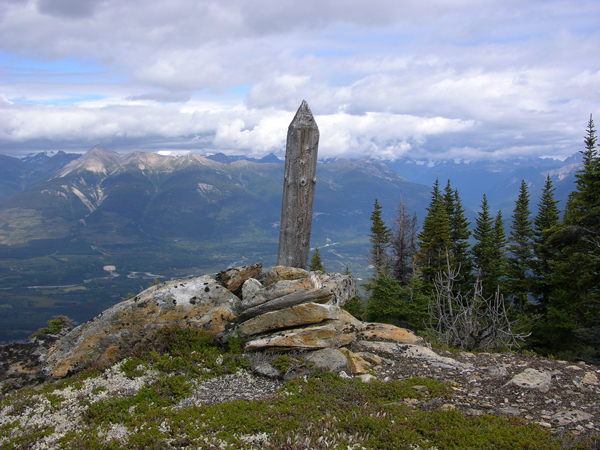
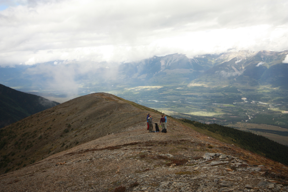
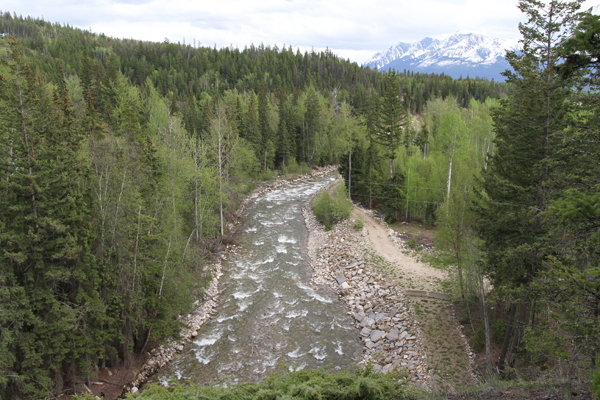
- Viewpoints: Several, of Mt. Robson, Tete Creek Valley, the Robson and Canoe Valleys, the Village of Valemount and Kinbasket Lake.
- Geocache points: Unknown
- Closest bathroom/outhouse: None nearby
- Cell service? Not comprehensive, but in spots.
- Gear to bring: Bring 2L water/pp and mosquito spray
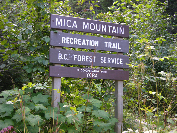
- Outside Links: Mica BC rec sites & trails
Trail Description:
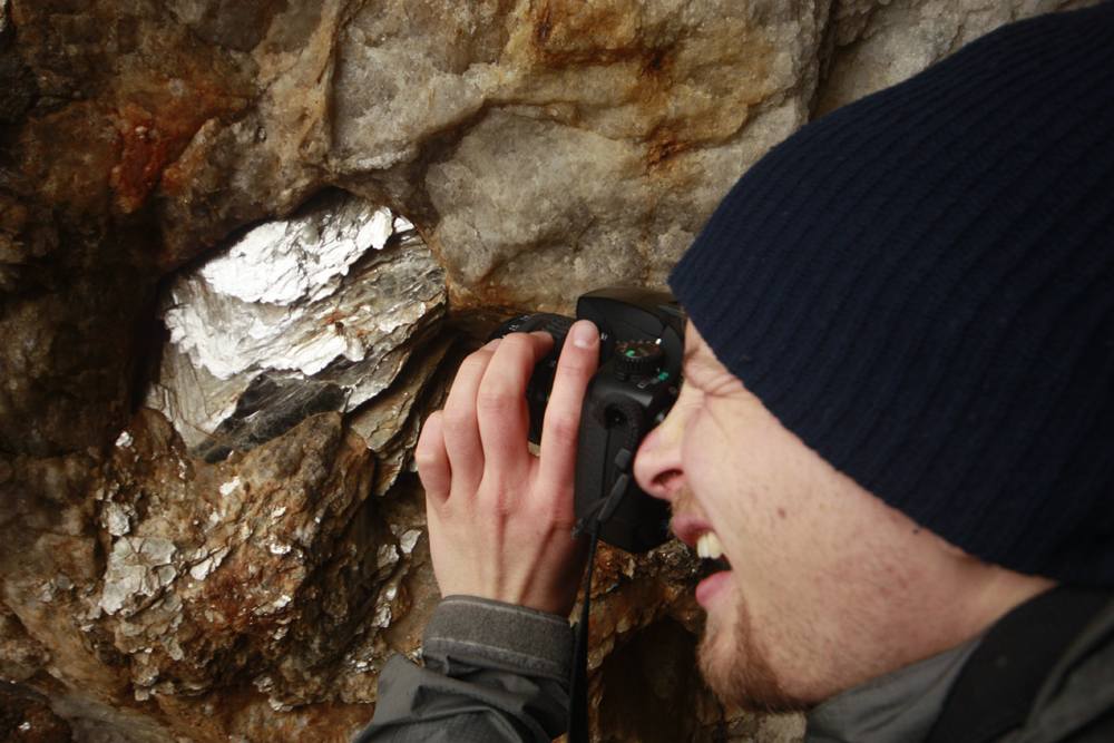
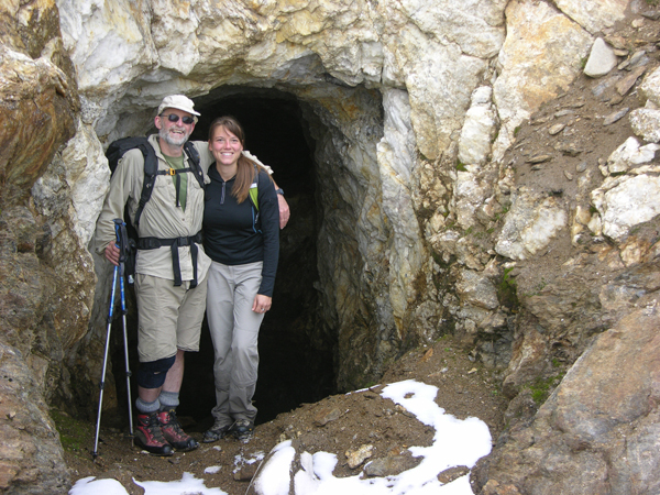
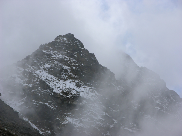
As you climb up the steep, narrow trail of Mica Mountain, picture a laden mule just in front of you. Imagine its cart full of mica flakes shoveled out from the 30 degree hillside at 7000 feet. The bottom part of the trail is in the forest, but once you get to the alpine, the trees disappear completely. On cloudy days the alpine can be foggy, wondrous too, when your footsteps lead you to what looks like a pond of glassy rocks. The rocks shimmer like hundreds of tiny mirrors. This is where they loaded the mules. To your right is the old mine site. Mica was used for lining wood stoves and insulation early last century. From the mine you can scale the steep hillside to the ridge (no trail). This ascent is steep enough to cause vertigo. On a clear day from the ridge you can see all the way to Mt. Robson as well as the Robson and Canoe Valleys to Kinbasket Lake. Someone has constructed a picnic table and roofless shelter out of rock slabs on the ridge. The peak? Still far away, hidden behind sub-peaks and clouds.
Best Parts:The Mica Mine is of course one of the most unique and amazing parts of this hike, but so is the perspective of the Robson and Canoe Valleys. You can see Mt. Robson and Kinbasket Lake in the same field of view on a clear day.
Worst Parts: There are some very steep, rocky sections that are slippery when wet and it’s hard to grip unless you’re wearing good hiking shoes. The bottom trail becomes a creek during wet weather. Hiking poles, good shoes and caution are recommended for these sections, as they become extremely slippery. Be sure to make lots of noise so you don’t surprise any bears and they have time to leave to avoid an encounter. The mosquitoes are bad during the summertime – but nothing a little mosquito spray or net shirt can’t handle.
GPS Zone:
Trailhead coordinates: 52.920683°, -119.497012°
(Insert into Google Maps search bar or GPS)
GPS Tracks (Right click, Save link as)
Download Mine Trail GPX file
Download Mine & Ridge Trail GPX file
How to access/where to park: From the Visitor Centre, head north towards Tete Jaune Cache. Turn onto Blackman Road, then onto Old Tete Jaune Road. From there, you’ll take the Sand Creek Forest Service Road. Click here for Google Maps directions.
