Add to favorites

- Difficulty: Medium–Hard

- Warnings: No official warnings.
- Wheelchair accessible: No
- High-clearance 4×4 advised to access trailhead? no
- Best seasons: summer, fall, winter (ski/snowshoe)
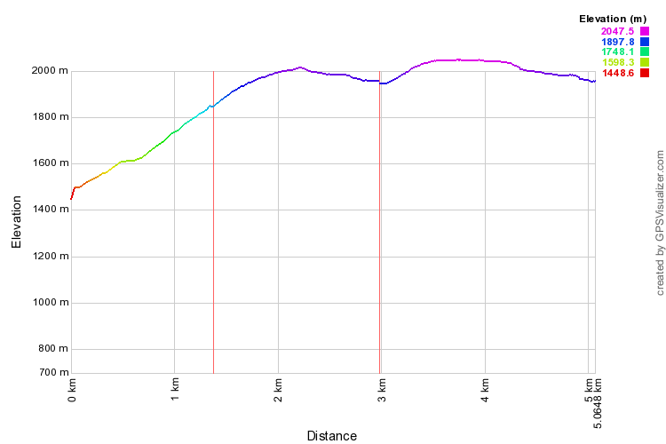
- Distance (one-way to cabin): 6 km/3.7 mi
- Distance (one-way to ridge): 10km / 6.2 mi
- Approx. time: 3-4 hrs return to cabin / 4-5hrs return to ridge (add another 20 mins each way for driving up 5-Mile to the trailhead
- Elevation gain (cabin): 500 m/1640 ft
- Elevation gain (ridge): 700 m/2300 ft (NOTE: if you go to the cabin before the ridge the climbing elevation gain is 1000m due to the undulating terrain)
- Steepest grade: 20+%
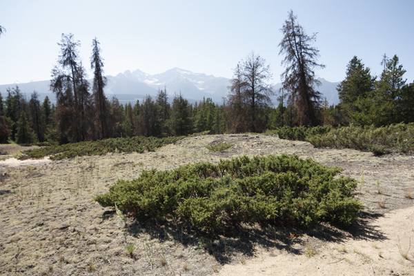
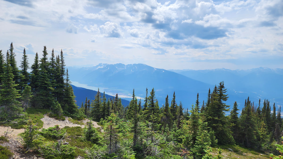
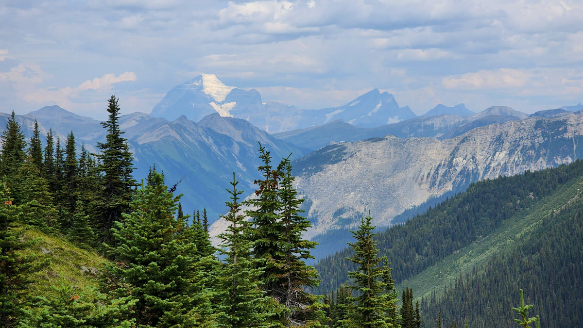
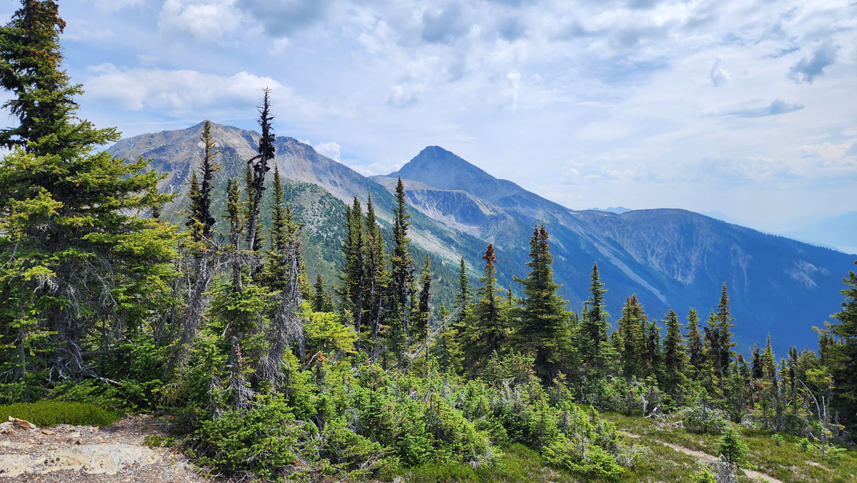
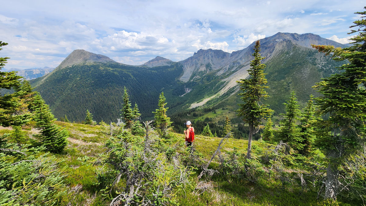
- Viewpoints: Stunning views of Kinbasket lake (at the benches partway up), and once in the alpine great views of Kinbasket, Mt. Robson, and the Premier Range vista.
- Geocache points: Yes
- Closest bathroom/outhouse: Outhouse at the cabin
- Cell service? Signal in most areas (not all service providers cover the Robson Valley!).
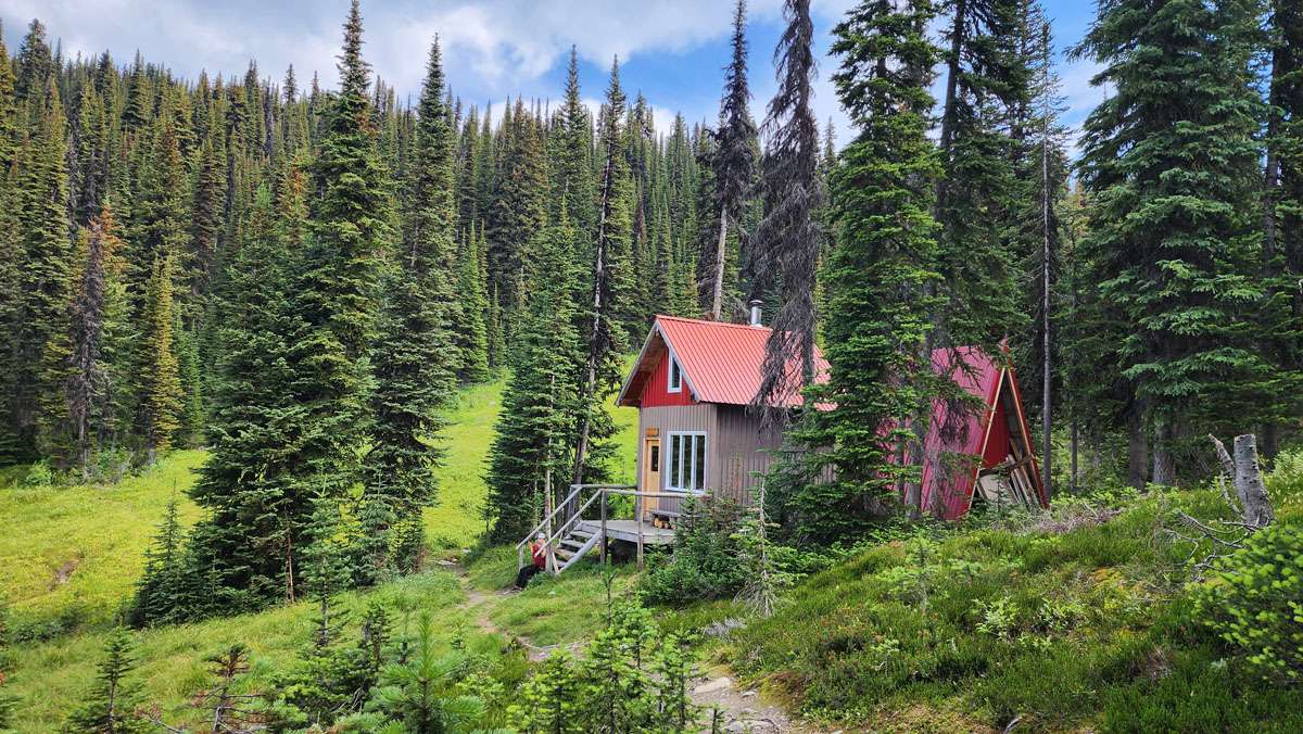
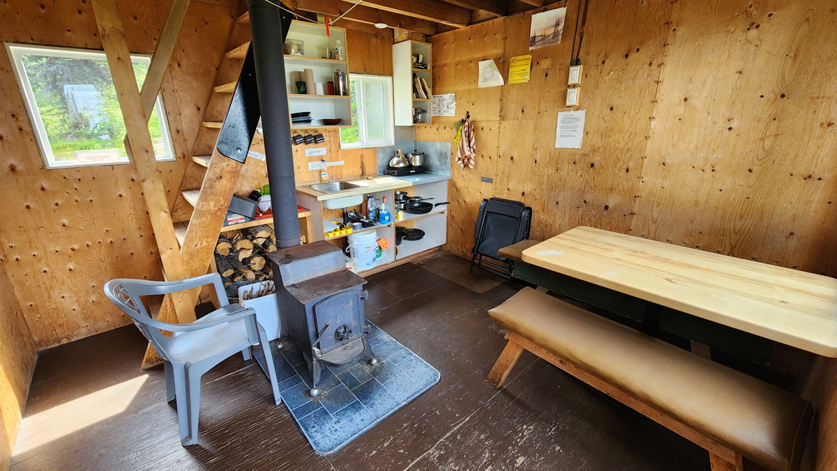
- Cabin Details: Cabin sleeps 4 comfortably but can accommodate up to 6 people as there are 6 foamies available. There are also pots, pans, dishes and wash basins. A cooking stove is provided but you must bring your own propane (green canister available at most grocery and hardware stores). Wood stove available and wood supply is outside of the cabin. There is access to water at a small creek on the east side of the cabin (boil or filter drinking water).
- Gear to bring: Bring hiking poles (for downhill), mosquito spray and on a hot day bring 1.5 L water/per person as there is no water until you get to the creek at the cabin
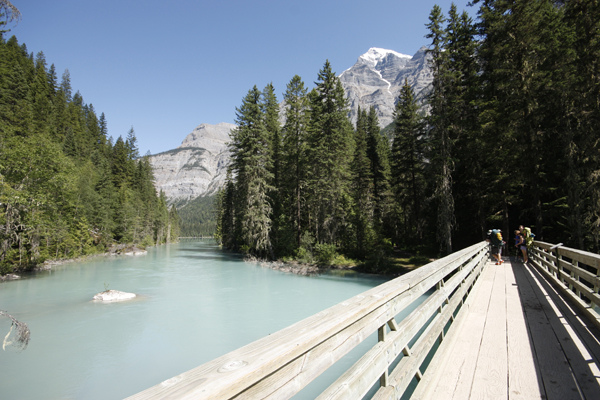
Trail Description: For those looking to get into the alpine, the McKirdy Meadows Trail is a great choice! With a relatively high elevation trailhead of 1,500 metres, an improved access road and the recent addition of switchbacks to avoid the extremely steep sections, this trail has become a local favourite that you won’t want to miss. The 6km trail to the alpine goes through a mixed forest which has some nice view points along the way. When you arrive at the subalpine watch for directional signage which indicates the direction to the McKirdy Meadows and the YORA Cabin (note: the creek by the cabin is the only water source along this trail). From this point, the main trail continues across the meadow to another junction where one has four options: 1. Backtrack the way you came which is the shortest option. 2. Take the left fork which swings by the cabin and then back to the main trail junction. 3. Continue up to a nice ridge walk which leads to a lovely viewpoint with a great view of Mt Robson and also swings by the cabin and back to the main trail junction. 4. Take the right fork which drops down to the col where you have the option of continuing up to Carson’s Peak (the sub peak of Mt McKirdy) which is a steady climb with an elevation gain of 450 metres from the col. For those with some mountaineering/route finding experience, the Mt McKirdy summit is a very rewarding option with amazing views in all directions (note: if attempting the summit please watch for unstable/loose rocks on the final approach to the summit). The cabin can be booked by calling 566-8244.
Best Parts: Incredible views and a relatively short hike to the alpine due to the higher access road. Also the option of staying overnight.
Worst Parts: Watch for falling trees. Bears are sometimes spotted along this trail during spring and summer. Be sure to make lots of noise so you don’t surprise them and they have time to leave. The mosquitoes are very bad starting as early as mid-May and continuing until mid-summer. Bring bug spray and a netshirt/pants and avoid hiking at dusk. The flies can also be pesky, especially in the alpine.
GPS Zone:
Trailhead coordinates:
52.848831°, -119.218285°
(insert into Google Maps search bar or a GPS)
GPS Tracks (Right click, Save link as)
Download Trail GPX file
How to access/where to park: You can access this trail from near the top of 5-Mile Road. When dry, this road is usually fine for all types of vehicles, though the way down can sometimes be hard on automatic breaks. The maximum grade of this road is approx. 15%. See Google Maps directions here.
Elevation change profile (metres). (This profile includes the meadows only, not the ridge)